Where Colombia's hydro inflows are born
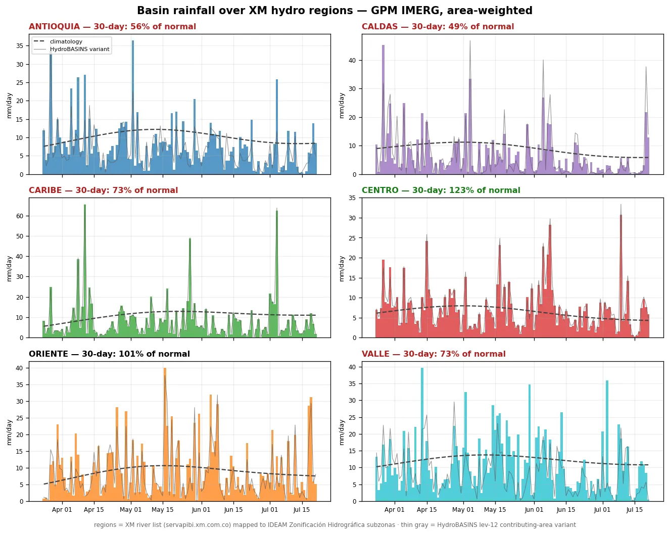
Colombia's grid is ~65–70 % hydroelectric, and its system operator XM tracks reservoir inflows ("aportes hídricos") across six hydrological regions. XM defines the regions as lists of monitored rivers, not as maps — so this page builds the missing polygons: each river's catchment from IDEAM's official Zonificación Hidrográfica (and, as a cross-check, upstream traces through HydroSHEDS HydroBASINS), then averages GPM IMERG satellite rainfall over each region, daily. Rain here today is turbine water in the coming weeks.
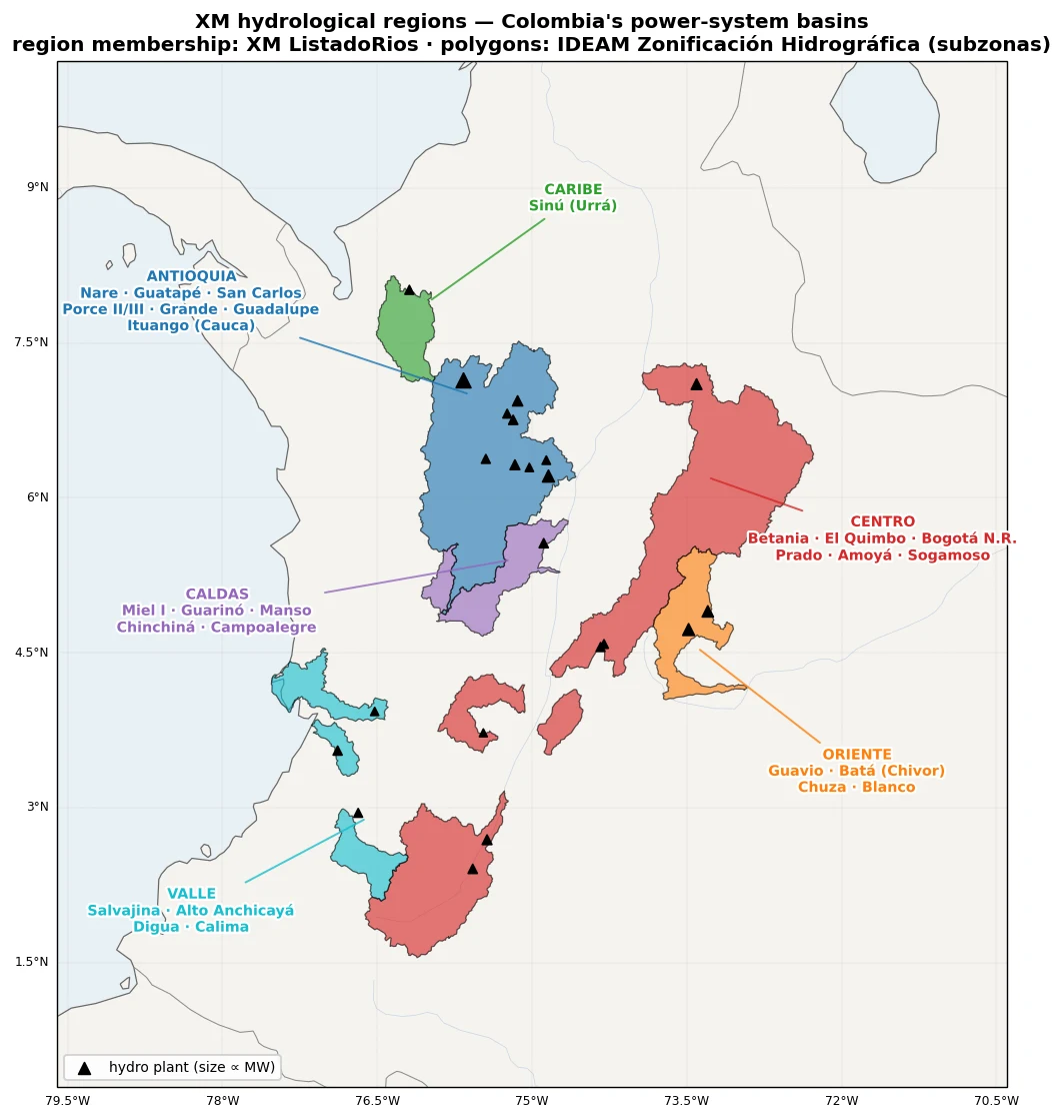
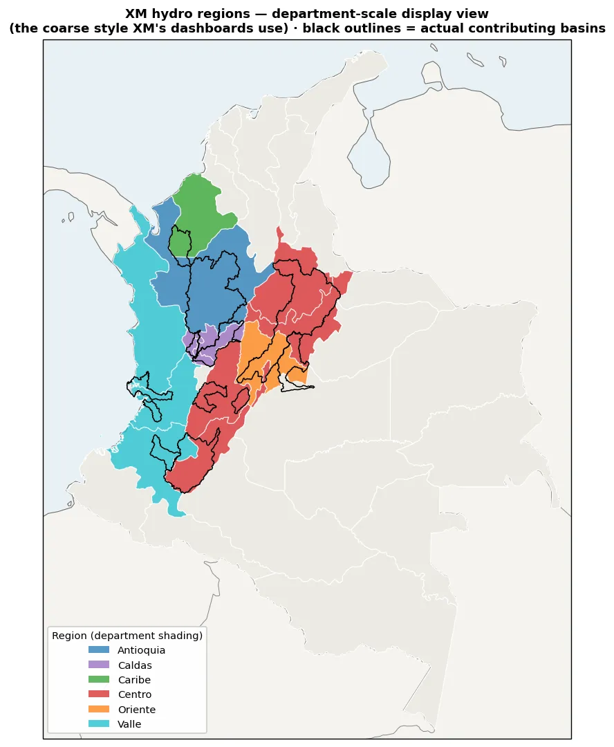
Two views of the same regions: the contributing basins (left — used for all rainfall averaging on this page) and the department-scale shading XM-style dashboards display (right), with the true basins outlined in black. Rain outside the black outlines never reaches a turbine.
Basin rainfall, daily
The regions
Membership exactly as returned by XM's public API (ListadoRios);
polygons are the union of the IDEAM subzonas holding each river's catchment. The regions
are deliberately basins, not departments — XM's own dashboards shade indicative
department-scale areas, but only these catchments actually convert rainfall into inflow.
| Region | Rivers / reservoir systems | Approx. area |
|---|---|---|
| Antioquia | Nare · Guatapé · San Carlos · Porce II/III · Grande · Guadalupe · Tenche · Ituango (Cauca) | 27,300 km² |
| Caldas | Miel I · Guarinó & Manso desv. · Chinchiná · Campoalegre · San Eugenio | 6,700 km² |
| Caribe | Sinú (Urrá) | 4,700 km² |
| Centro | Betania · El Quimbo · Bogotá N.R. · Prado · Amoyá · Cucuana · Sogamoso | 48,000 km² |
| Oriente | Guavio · Batá (Chivor) · Chuza · Blanco | 6,700 km² |
| Valle | Salvajina (alto Cauca) · Alto Anchicayá · Digua · Calima | 7,800 km² |
Data downloads
Shapefiles and GeoJSON, EPSG:4326. The IDEAM variant is composed of official government basin units; the HydroBASINS variant is the sharper contributing-area realization (level-12 upstream traces from each region's dams).
| File | Construction |
|---|---|
| xm_regions_ideam.shp.zip · geojson | IDEAM Zonificación Hidrográfica subzonas (official units), grouped per XM region |
| xm_regions_hydrobasins.shp.zip · geojson | HydroSHEDS HydroBASINS lev-12 upstream traces from region outlet dams |